
ESTUDIO DE PREFACTIBILIDAD PLAN MAESTRO DEL TERRITORIO CONCESIONADO EN ILO PARA BOLIVIA - MARBOLIVIA
Descripción General
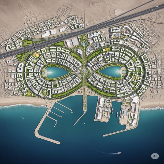
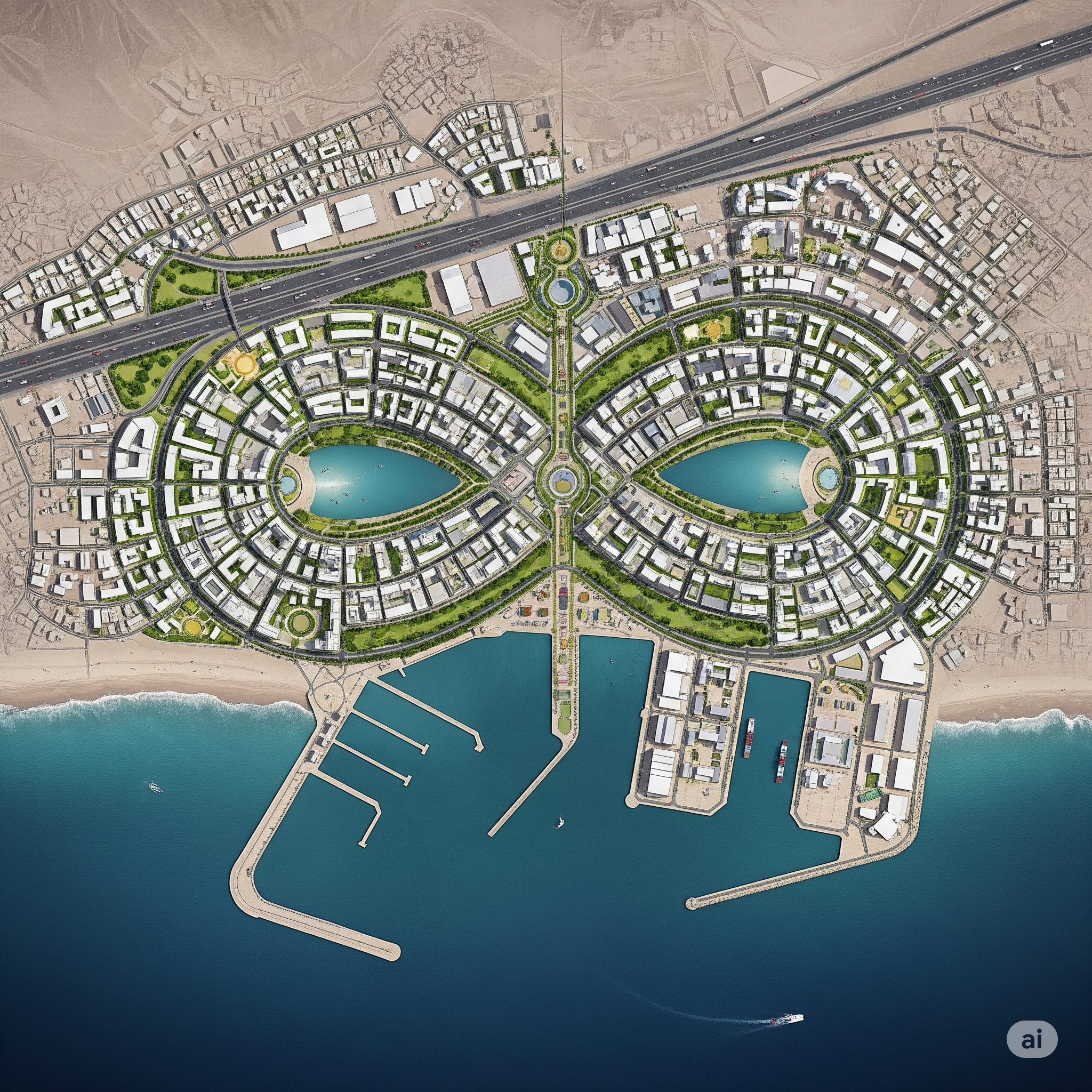
El proyecto abarcó un enfoque integral de planificación, diseño y evaluación en el ámbito urbano-portuario, incluyendo componentes de infraestructura, servicios básicos, desarrollo económico y sostenibilidad ambiental. Las actividades desarrolladas comprendieron el diseño urbanístico y planificación portuaria, formulación de políticas y planes de desarrollo portuario, y el diseño de obras de infraestructura portuaria, entre las cuales se destacan: Diseño de espigones de protección contra oleaje, muelles deportivos y pesqueros, así como propuestas de ordenamiento territorial y regulación urbana-paisajística. Se incorporó además un estudio oceanográfico con el fin de evaluar las condiciones físicas y dinámicas del entorno marino y su influencia en el diseño estructural y funcional del puerto. En paralelo, el proyecto contempló el desarrollo del Estudio a nivel de Prefactibilidad de sistemas de agua potable, alcantarillado sanitario y planta de tratamiento de aguas residuales, así como la propuesta de un sistema de micro-riego y el diseño del sistema de electrificación urbanística. Estas acciones permitieron evaluar la viabilidad técnica y operativa de los servicios básicos necesarios para el funcionamiento integral del área de intervención. Asimismo, se llevó a cabo la Evaluación de Impacto Ambiental (EIA) del proyecto, cumpliendo con las normativas vigentes en materia de sostenibilidad, mitigación y prevención de impactos negativos. Adicionalmente, se desarrollaron estudios orientados a la generación de unidades de negocio de carácter comercial y turístico, como parte de una estrategia de dinamización económica del territorio, acompañados de una evaluación socioeconómica para estimar los beneficios directos e indirectos para la población beneficiaria. Como componente transversal, se implementó un Sistema de Información Geográfica (SIG), diseñado específicamente para el proyecto, que permitió la integración, visualización y análisis de datos espaciales y temáticos, facilitando la toma de decisiones en cada fase del desarrollo, planificación y seguimiento del proyecto.
Galería
Área Técnica
Desarrollo Urbano
Tipo de Servicio
CONSULTORÍA
Ubicación
Ilo, Peru
Período
2013
ESTUDIO DE PREFACTIBILIDAD PLAN MAESTRO DEL TERRITORIO CONCESIONADO EN ILO PARA BOLIVIA - MARBOLIVIA
KRETCO S.R.L.
Ilo – Peru
El proyecto abarcó un enfoque integral de planificación, diseño y evaluación en el ámbito urbano-portuario, incluyendo componentes de infraestructura, servicios básicos, desarrollo económico y sostenibilidad ambiental. Las actividades desarrolladas comprendieron el diseño urbanístico y planificación portuaria, formulación de políticas y planes de desarrollo portuario, y el diseño de obras de infraestructura portuaria, entre las cuales se destacan: Diseño de espigones de protección contra oleaje, muelles deportivos y pesqueros, así como propuestas de ordenamiento territorial y regulación urbana-paisajística. Se incorporó además un estudio oceanográfico con el fin de evaluar las condiciones físicas y dinámicas del entorno marino y su influencia en el diseño estructural y funcional del puerto. En paralelo, el proyecto contempló el desarrollo del Estudio a nivel de Prefactibilidad de sistemas de agua potable, alcantarillado sanitario y planta de tratamiento de aguas residuales, así como la propuesta de un sistema de micro-riego y el diseño del sistema de electrificación urbanística. Estas acciones permitieron evaluar la viabilidad técnica y operativa de los servicios básicos necesarios para el funcionamiento integral del área de intervención. Asimismo, se llevó a cabo la Evaluación de Impacto Ambiental (EIA) del proyecto, cumpliendo con las normativas vigentes en materia de sostenibilidad, mitigación y prevención de impactos negativos. Adicionalmente, se desarrollaron estudios orientados a la generación de unidades de negocio de carácter comercial y turístico, como parte de una estrategia de dinamización económica del territorio, acompañados de una evaluación socioeconómica para estimar los beneficios directos e indirectos para la población beneficiaria. Como componente transversal, se implementó un Sistema de Información Geográfica (SIG), diseñado específicamente para el proyecto, que permitió la integración, visualización y análisis de datos espaciales y temáticos, facilitando la toma de decisiones en cada fase del desarrollo, planificación y seguimiento del proyecto.